Every operation must start with a plan.
In this first of several articles we look at the key considerations an operator must make when planning a spray job.
Introduction
“Failing to prepare is preparing to fail”
“Poor preparation = Poor performance”
We’ve heard it all before!
Operating a drone for aerial spray applications involves multiple parameters to ensure safety, efficacy, and compliance with regulations.
In a previous article we looked at the importance of creating a property map. A spray plan expands on this process by encompassing aspects of the Job Feasibility Study, Job Safety Assessment, and Risk Assessment into a single comprehensive planning document.
Below we will break down some of the key considerations that go into a good spray plan…
Regulatory Compliance
Licensing and Certification
You must ensure that whoever is actually going to operate the drone has the necessary licenses and certifications required by CASA – i.e. a RePL & ReOC.
In addition to this, spray operators are often required to hold additional licenses issued by the relevant State/Territory environmental agency.
Chemical Regulations
Operators must comply with local agricultural and environmental regulations concerning the use of specific chemicals. Most States/Territories will also require anyone who is handling or mixing chemicals to hold a relevant qualification.
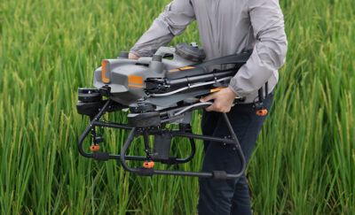
Drone Specifications
Payload Capacity
 If you are lucky enough to own more than one aircraft you may need to choose the most appropriate platform for the job!
For broadacre treatments on large flat fields a larger drone with sufficient payload capacity to cover wide areas would be preferred. However, if spot spraying in a difficult access location such as a dam wall, using a 100kg+ behemoth may not be the safest option! In this case a smaller 10L platform would be better suited for these tight spaces.
Battery Life and Flight Time
Performing flight time calculations during the planning stage will allow you to plan for the number of batteries you need to use and therefore the charging requirements on site. Agricultural drones do not fly for very long per battery set so planning an efficient operation is critical.
Navigation and Control
All drones should have reliable GNSS and navigation systems installed. This allows for not only precision application but also safety features such as Return to Launch.
Even if the operation involves only manual spot spraying tasks, a good GNSS system allows for precise flight logging and spray records.
RTK (Real Time Kinematics) is not always necessary but if it is required for your operation consider what additional equipment and setup time is needed once on site.
Spray System Specifications
Nozzle Type and Configuration
Choose the appropriate nozzles to achieve the desired droplet size and spray pattern.
NOTE: This is only applicable to systems that use TeeJet style nozzles. Systems that use CDA technology are able to modify droplet size and pattern automatically through software settings.
Flow Rate
Some modern systems will automatically modify flow rate based on the current flight speed and selected application rate. Older system however may have limited capability so it is necessary to calculate flight speed based on available flow rate to achieve the desired application rate.
Pre-Flight Preparation
Site Assessment
It is crucial to conduct a thorough assessment of the target area, including:
- Topography
- Obstacles
- No-fly zones/No-spray zones
- Environmental conditions
- Infrastructure/Buildings
- Utilities
- Native flora and fauna
All these items should be considered in detail through documentation and indicated on a Property Plan.
Weather Conditions
Check weather forecasts to avoid spraying in high winds, rain, or extreme temperatures. Delta-T parameters of air temperature and relative humidity are fundamental to predetermining the application condition.
Local knowledge or historical records for a site may help to identify the best time for aerial application, particularly if an area is prone to phenomena such as storms or temperature inversions.
Calibration
You should always calibrate the spray system to ensure accurate application rates. This involves setting the correct flow rate and checking the spray pattern.
If applicable, follow manufacturer guidelines for spray system calibration as this may be an automated function within the software. However, in some older systems calibration may need to be done manually depending on available pump pressure and flow rate, and nozzle type selected.
Flight Planning
Flight Path Design
Modern field planning software will automatically design an efficient flight path based on preselected parameters to ensure uniform coverage with the minimum of wasted flight time.
Altitude and Speed
Set the appropriate flight altitude and speed based on the type of crop to be treated, chemical to be used, and environmental considerations such as spray drift.
Be aware that some State/Territory environmental agencies have guidelines or regulations on spray height and speed that must be adhered to.
Overlap
Ensure sufficient overlap between passes to prevent gaps in coverage. Automated flight paths should ensure a minimum of 10% overlap to avoid striping. Assessment of wind conditions should also be taken into account to consider slight variation in spray pattern and drift.
Manual Flight
For manual application, predetermine the best options for efficient flight paths and loading to ensure maximum coverage and operational efficiency. Include a trained navigator where required to monitor height and speed throughout the pass.
On more technically complex operations the flight crew may include PIC, navigator, and loader to maximise operational efficiency.
Depending on the skill level of the PIC and navigator, a larger overlap may be preferred to prevent striping.
Operational Safety
Protective Gear
The handling, mixing, and aerial application of chemicals will necessitate the use of extra personal protective equipment (PPE). Make sure that the required PPE is documented and available for all member of the flight crew.
Emergency Procedures
In addition to standard emergency procedures for drone operations, procedures should be documented for events such as chemical spill or personnel exposure to toxic substances.
Monitoring and Data Collection
As part of your plan you should document how the operation will be monitored, particularly during automated flight, to ensure the correct flight path is followed. A member of the crew should be tasked as part of the pre-flight briefing to confirm the spray system activates/deactivates as planned and that there are no deviations in spray pattern.
Make sure that you are able to collect data on spray coverage, flow rate, and environmental conditions as these will be required for post-flight analysis and inclusion on spray records.
Post-Flight Procedures
Following an operation, have a plan to verify that chemical was applied evenly across the target area using data collected during the flight.
Safe cleaning procedures should be in place to ensure the longevity and efficiency of your spray system as well as prevent unnecessary environmental contamination.
Post-flight checks should be documented in the operational records.
Documentation
Record Keeping
All operators undertaking aerial application of chemical are required to maintain detailed records of flight plans, chemical usage, calibration settings where appropriate, and incidents occurring.
Different States/Territories may have different rules for record keeping but as a general rule records must be completed within 48 hours of the operation and held for a minimum of 3 years.
Reporting
Reports should be submitted to relevant authorities as required or held within a secure database. This may include providing a chemical application record to clients/landholders for future reference.
References
- University of California Agriculture and Natural Resources: Provides guidelines on aerial spray application and calibration.
- Texas A&M AgriLife Extension: Offers resources on best practices for aerial application using drones.
- DroneDeploy: Provides tools for flight planning and monitoring for agricultural applications.
- Pix4D: Advanced mapping software for precise agricultural applications.
Additional Resources
- Civil Aviation Safety Authority (CASA): For aviation regulations and guidelines in Australia.
- Agricultural Extension Services: Local guidelines and best practices for aerial applications.
- Environmental Protection Agency (EPA) NSW: Environmental authority with guidelines and regulations for aerial application.
- Australian Pesticides and Veterinary Medicines Authority (APVMA): Regulations for chemical application in Australia.
Let’s Get Started
Don’t trust your future to anyone else. FPV Australia have you covered. Contact us NOW!